On the main highway south of Tulum in Mexico there’s a beautiful little cave system called Sistema Hatzutz Actun.
About the cave:
- colourful - lots of gold formations
- beautiful formations, highly decorated rooms
- great fossils - molluscs, sponges
- halocline at 20 metres
- maximum depth 23.5 metres
- still contains original exploration markers
- blind cavefish, remipedes
- mainline passable on backmount
- sidemount recommended for many passages, multiple restrictions
- line tension isn’t great in some sections, take care in the halocline
- decompression may be required
- insufficient length to warrant DPVs
- no cavern diving
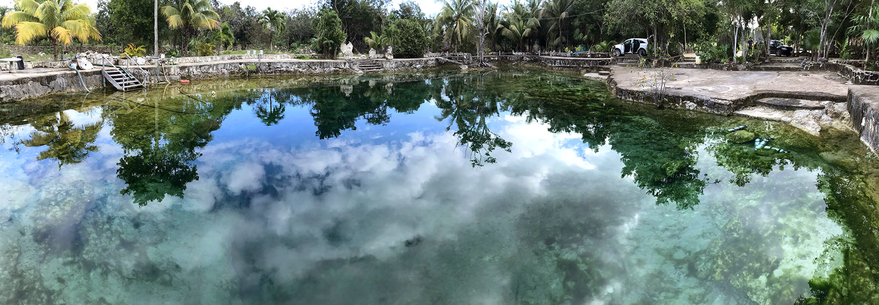
Panorama of Cenote Hatzutz Aktun
Directions to get there:
Highway 307, south of Tulum. The Zero Gravity Dive Centre has Cenote Hatzutz Aktun as KM 47.5 from the shop (there’s variability between cars, my odometer read 46.9 km). It’s 1.7 km south of Cenote Cristal (Naharon), on the same side of the road (right, as travelling south from Tulum). The stone entrance has a small red dive flag and a decorative iron gate that will be open.
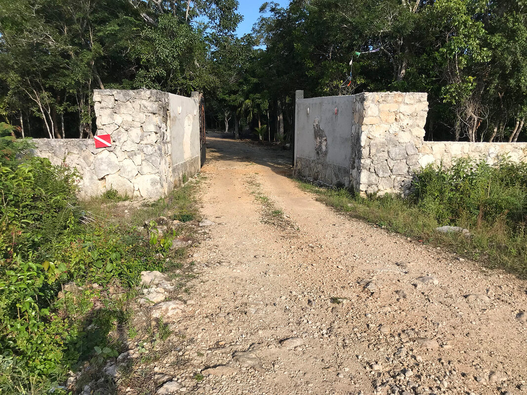
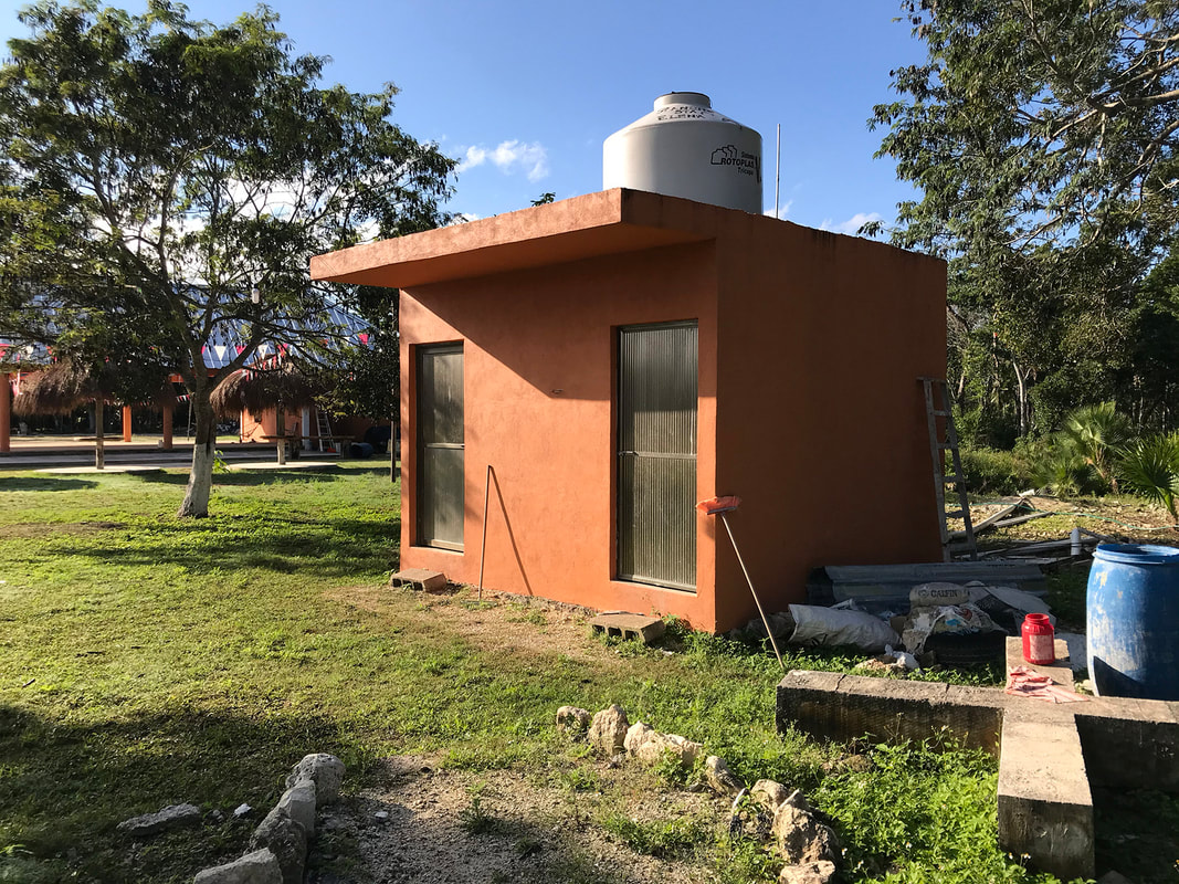
The highway entrance to Cenote Hatzutz Aktun
Don’t be fooled by the pool of water on the left about 100 metres in. Keep driving past the buildings, strings of flags and horse corral, the cenote is 300 metres in. Look out for all the cats and dogs as you drive through.
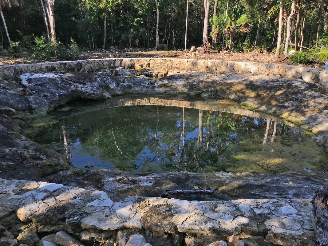
This is NOT your dive site. Keep driving.
Dive site information:
Entry fee for cave divers:
MX$250 per diver (February 2020). The landowner’s employees will come and find you at the cenote to collect money and get you to fill out the dive log book.
Locating the line:
The cave line comes to open water. It’s located on the cenote floor a bit out from the end of the platform. It will be easy to find if the cenote water is clear (in December) but may be more difficult if the water is green. The cave entrance isn’t very high (top to bottom). There’s room at 6 metres to drop O2 tanks (if required).
This cenote has been modified. Expect a heavy silt load inside the cave entrance.
This cenote has been modified. Expect a heavy silt load inside the cave entrance.
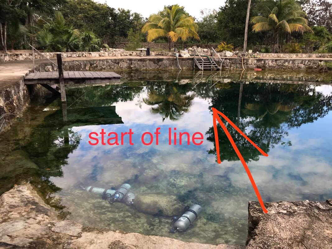
The cave line comes to open water in Cenote Hatzutz Aktun
Depth:
The maximum depth for the cave is listed on the map as 23.5 metres. The halocline is at 20 metres.
Facilities:
There is a brown painted cement toilet block with 2 toilets. Head back up the path towards the road, on your right. I don't like to ever assume there will be toilet paper!
There are no benches near the carpark for twinset divers. There is a nice wall you can stand your doubles on to get them on easily.
There are no benches near the carpark for twinset divers. There is a nice wall you can stand your doubles on to get them on easily.
Toilet block at Cenote Hatzutz Aktun
Map:
There’s a nice cave map at the site drawn by Nadia Berni (2017).
Stick map:
*Map not to be used for navigational purposes. Why not? Because lines change, navigational markers change, cave exploration may continue and nobody's life should depend on a hand-drawn map they found on the internet. Please take care navigating while cave diving and reference the cave as you find it in the water.
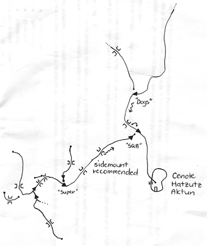
Stick map for Sistema Hatzutz Actun*
Disclaimer:
Information changes quickly in Mexico and often without warning. It's a good idea to check on cenote access with a local cave diving centre before hitting the road.

 RSS Feed
